Land for Sale in Zimbabwe: How to Avoid Wetland Demolitions with GIS Mapping
Introduction: A Nationwide Reckoning
In early 2024, the images were impossible to ignore: bulldozers reducing homes to rubble in Harare’s Budiriro suburb. The government, enforcing the Environmental Management Act, began demolishing structures built on protected wetlands. The Harare City Council reported over 1,200 illegal structures earmarked for removal, representing a collective loss of millions in investment. For anyone searching for land for sale in Zimbabwe, a chilling question now dominates: “Could my dream property be next?”
This isn’t just about a few unlucky homeowners. It’s a nationwide reckoning with environmental law that has exposed a critical gap in our property market: the dangerous disconnect between what we see and what science says. This post reveals why wetlands are legally protected no-go zones, the catastrophic cost of ignoring this, and how Geographic Information Systems (GIS) mapping is the only tool that provides the certainty needed to invest safely and avoid becoming the next demolition headline.
Understanding Wetlands: Beyond the “Damp Ground” Myth
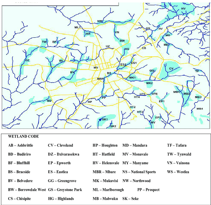
A wetland isn’t just a visible swamp or marsh. According to Zimbabwe’s Environmental Management Agency (EMA), wetlands are ecologically sensitive areas defined by their hydrology, soil, and vegetation. They are nature’s kidneys, vital for water filtration, groundwater recharge, and flood mitigation, especially in urban catchments.
The Legal “No Development Zone”
The law is unambiguous. The Environmental Management Act and supporting statutory instruments designate wetlands as protected ecological areas. Development is prohibited. The government’s demolition drive isn’t arbitrary aggression; it’s the enforcement of long-standing legislation designed to preserve Harare’s delicate water security and ecosystem stability. When you consider that Harare’s wetlands help regulate water for over 2 million residents, their protection becomes a public necessity, not an optional guideline.
The Critical Point: Wetland boundaries are scientific, not visual. What appears as dry, buildable land in July can be a legally protected wetland basin. Relying on a visual inspection or an agent’s assurance is a recipe for financial disaster.
The Two-Fold Danger: A Catastrophic Gamble
Building on a wetland isn’t a minor risk, it’s a guarantee of dual failure: legal and environmental.
A. The Legal & Financial Hammer: Demolition Risk
The state’s mandate is clear. The Ministry of Environment, Climate, and Widlife has been tasked with restoring wetlands. The consequence for illegal structures is total removal.
Consequence 1: Total Investment Loss. There is no compensation. You lose the land value, construction costs, and everything built on it.
Consequence 2: Criminal Liability. Violators can face fines and legal prosecution under the EMA.
B. The Environmental Boomerang: Inevitable Hazard Risk
Even if a structure temporarily avoids demolition, nature will exact its toll.
Structural Failure: Wetland soil is unstable. Foundations crack, walls shift, and buildings sink.
Chronic Flooding: Wetlands are designed to hold water. Your property will flood, repeatedly, causing relentless damage and health hazards like mold.
Compounded Crisis: You create a personal disaster while contributing to a city-wide one by degrading the natural infrastructure that prevents urban flooding.
The Agent’s Omission: Why Is This Risk “Overlooked”?
If the risk is so severe, why do people still buy wetland plots? The answer often lies in the information gap at the point of sale.
Short-Term Gain vs. Long-Term Client Disaster: The agent’s primary goal is a commission. A detailed wetland analysis that could kill a deal is often omitted.
Lack of Technical Tools: Most agents don’t have access to or understanding of GIS technology. They cannot verify wetland boundaries scientifically.
The “It Looks Dry” Fallacy: The most dangerous phrase in real estate. It ignores the legal and hydrological reality for a surface-level observation.
The Scientific Solution: GIS Mapping & Buffer Analysis
This is where we move from fear to clarity. The solution isn’t guesswork; it’s geospatial science.
GIS is a technology that layers multiple data sets—satellite imagery, topographic surveys, hydrological models, and legal boundaries—onto precise digital maps. It turns abstract regulations into visual, verifiable truth.
The Critical Tool: Buffer Analysis
This is the cornerstone of safe planning. A buffer is a calculated zone around a wetland where risk remains high due to water flow, seasonal expansion, or enforcement policy.
High-Risk Buffer (0-50m): Direct impact zone. Demolition is almost certain.
Moderate-Risk Buffer (50-200m): Subject to flooding and potential enforcement. Requires extreme caution.
Low-Risk Buffer (200m+): Generally safer for consideration with proper due diligence.
A GIS-generated buffer map doesn’t just show you the wetland; it shows you the danger zone around it.
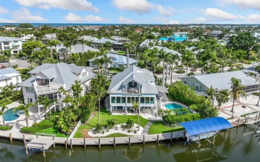
Case Study: A Tale of Two Plots
| Plot A (No GIS Check) | Plot B (With GIS Check) | |
|---|---|---|
|
Location |
Budiriro, near a grassy field |
Glen Lorne, 250m from a wetland |